It was 40 years ago that man landed on the moon and now in conjunction with the 40 year celebrations, Google has launched Moon in Google Earth. With this new feature of Google Earth, it is now easier for almost anyone to learn about space, the moon and some of the most significant and amazing discoveries humanity has accomplished together.
Moon in Google Earth enables you to explore lunar imagery as well as informational content about the Apollo landing sites, panoramic images shot by the Apollo astronauts, narrated tours and much more.
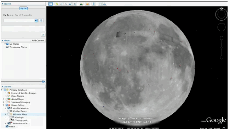
To get to the moon you need to download the latest version of Google Earth and start it. Then just click the planet button on the top toolbar and choose Moon. Now instead of the earth you will see the moon. All the normal Google Earth control are available, you can zoom, as well as drag your mouse on the moon to fly around.
In the lower-left corner is the Layers panel, from it you can control what information is layered on top of the moon image. The Layers panel includes some impressive content including information about each of the Apollo landing missions, the Human Artifacts layer with locations and trivia on every robotic spacecraft that’s ever landed on or crashed into the moon and the Historical Maps layer which lets you see the maps that NASA itself used in the Apollo missions.
Moon in Google Earth was made possible by Google’s Space Act Agreement, which allowed NASA Ames researchers to help Google develop much of its content. Also the terrain information came from JAXA, Japan’s space agency.
Related links: